Cirrus
What is Cirrus?
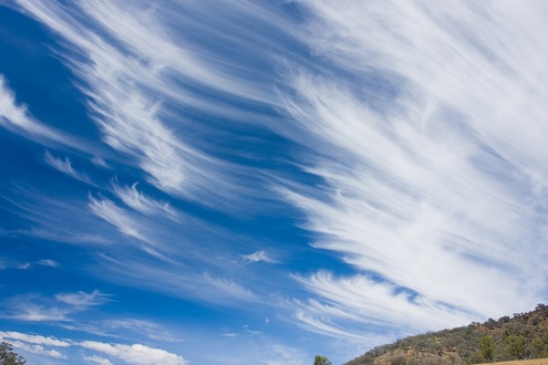
These clouds are created by
windblown ice crystals and are so thin as be nearly transparent. Cirrus clouds
may resemble long streamers, feathery patches, strands of hair with a curl at
the end, or a number of other distinctive shapes.
Cirrus clouds may appear in small patches or extensive areas of the sky. In the former case, they are associated with fair weather. These clouds are carried across the sky from west to east by the prevailing winds, the winds blowing in the direction that is observed most often during a given time period. Sailors used to measure the speed of winds aloft, which blow in the middle and upper layers of the troposphere, by the appearance of cirrus clouds: the longer the streamers, the faster the wind.
When the cirrus cover grows thicker in the west and takes on a crisscross pattern, it means that warm air is advancing at high altitudes. This is the first sign of an approaching warm front. After that, one can expect to see the development of a thick layer of cirrostratus. Clouds will develop at progressively lower heights a the rain approaches.
